|
|
|
|
|
The Fulcrum Insider
|
Essential insights for field-focused teams
|
|
|
|
|
This month’s Fulcrum Insider is packed with practical, field-ready content. We’re highlighting GIS tools that help you track assets, define boundaries, and speed up inspections, plus examples from five industries and two can’t-miss reads on real-world GIS in action.
|
|
|
|
 Webinar
|
|
|
|
|
|
|
Beyond features: Fulcrum’s impact on fieldwork
|
Hear directly from the Fulcrum product development team how our latest updates, including enhanced ArcGIS integrations, improve data quality and ease field workflows.
Register now ►
|
|
|
|
 Infographic
|
|
|
|
|
Real-world GIS for environmental fieldwork
Environmental work gets messy, but your maps shouldn’t. See how lines and polygons give field teams the clarity they need.
Read more ►
|
|
 Data Sheet
|
|
|
|
|
GIS asset management and the power of lines and polygons
Think your asset system has it covered? Not without GIS. This data sheet shows how lines and polygons close the gaps of traditional tools.
Read more ►
|
|
|
|
Geospatial clarity in horizontal construction
See how shapes speed the build. This infographic shows how field teams use lines and polygons – not pins – to map progress, track assets, and tie inspections to real site features. Learn how every fieldwork detail gets captured in the moment and linked to your workflow.
Read more ►
|
|
|
|
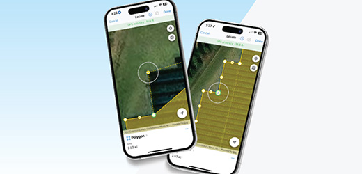
Five industries leveraging GIS lines and polygons for smarter field operations
From buried pipes to boundary lines, GIS lines and polygons are powering smarter fieldwork across five key industries. Learn how teams are using them to speed up inspections, cut errors, and make the most of every site visit.
Read more ►
|
|
|
|
 What we're reading
|
|
|
|
|
|
Leveraging GIS for enhanced facility and vertical asset management
Water utilities are rethinking how they manage assets, especially inside the fence. This Esri piece explores how GIS brings structure, context, and visibility to vertical infrastructure, offering lessons for anyone mapping complex systems in the field.
Read more ►
|
|
|
|
How high-resolution imaging and AI can be leveraged to streamline infrastructure inspection and maintenance
When infrastructure teams are stretched thin, high-resolution imagery and automated defect detection help field crews work smarter. This piece explores how these tools speed up inspections, reduce downtime, and let teams focus on real fixes, without wasting time on what’s working fine.
Read more ►
|
|
|
|
Data plays big role in government natural disaster response
When natural disasters hit, agencies like NASA and USGS depend on GIS to coordinate faster and work smarter. This piece looks at how spatial data improves clarity in the field, supports real-time decisions, and helps teams avoid costly missteps during response.
Read more ►
|
|
|
|